Owners: J. Balfour, Esq.
| See Balbirnie
Colliery entry (East Fife Index)
for fuller details of the old workings of this very important, early Fife coalfield, close by Markinch. |
|---|
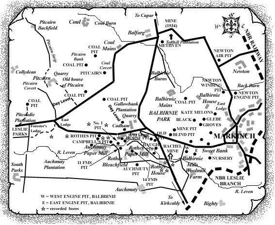
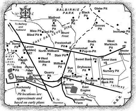
We have reason to believe that two early coalworks in the Balbirnie field were identified at some stage of their development as 'Roadside Pits', and that the information in the abandonment plan here may relate to the pit which was located at, or near, the 1st pit on the East Day Level in the Blinkbonnie district (see map). It is thought by one source that this pit was later renamed the Horse Pit, and if so, this pit was known from the early 1700s until around 1890. It is thought to have been sunk to the Main Coal at a depth of 12 fathoms, but in the later stages, Little Coal may also have been raised via this shaft.
A second 'Roadside Pit', dating from around 1830, is believed to have been renamed the Millbank then the North Millbank Pit (see map).
 |
 |
| See also the separate East Index entries for Horse and North Millbank Pits. |
|---|
| Plan of Abandoned Seams for Roadhouse Pit, Balbirnie | Pits or Mines designated in Plan |
|---|---|
| COAL; Main; Upper; Under; Little (1884) |
BALBIRNIE
Blawhither; Brierbush; Bye; Dryhouse; Engine East; Engine West; Haugh; Leven; Pitcairn; Pitmillan; Quarry; Roadside [Plan Custodian: Wm. Marshall, Sweet Bank, Markinch] |
