Owners:
1880 Kellie and Balcormo (A. G. Yooll)
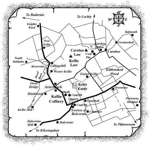
The Newton of Balcormo pit lay just south of Kellie Castle Colliery and was probably working at the same time as the pits of Kellie Castle. Mining in this area had probably taken place since the 18th century and the dates of the pit opening and closure are not known.
Statistical Account of Scotland: Parish of Carnbee (1793)
"... some years ago, there were coals wrought to a pretty considerable extent, at Over Carnbee, Balcormo, Cassingray, and in some other lands in this parish, whereas now there is not any one coal-work going on within the bounds of the parish; the necessary consequence of which has been, that a great many of those colliers, and other work-people in that line, who were wont to find constant employment here, found themselves under the necessity of going elsewhere for business, in the way to which they had been accustomed."
Nineteenth century directory: Carnbee
"... the parish has excellent deposits of limestone,
freestone and coal, the latter being worked at Newton of
Balcormo and Cassingray."
 |
 |
 |
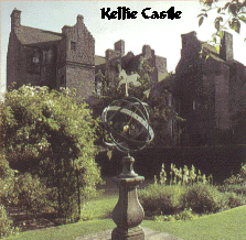 |
| Kellie Castle |
Information on coals worked near Newton of Balcormo
(based on a report from 1900)
The "Kellie Coals" were apparently quite well
known and commercially important in this area of east Fife.
They comprised two seams; the lower seam, called the
'Fore Coal' was described as being from 4 ft. 6 in.
to 7 ft. thick, with a shale parting 2 in. thick
approximately 2 ft. from its pavement, and 3 in. of
slate-clay near its roof, which was composed of hard
shell-limestone about 3 ft. thick. The upper coal seam was
known as the 'Back Coal' and it lay 132 ft. higher in
the series. It was described as being 9 ft. thick, with three
shale partings in it, about equal distances from each other,
and there was 9 ft. of roof composed of hard, black,
bituminous slate.
Kellie Castle Colliery and the Balcormo pit were still
working in the early 1870s to supply furnace coal to the Oil
Works then in operation near Kilrenny, Mr. Graham Yooll being
the lessee. The coal was described as 'coarse and
dirty' and was one of the few coals in the Calciferous
Sandstones of Fife being wrought commercially around that
time. Some years later, the Fife Coal Company bored to the
two coals at Lochty, two miles to the north of Newton of
Balcormo, but the results were not such as to induce
operations for working the coals. A record of the seams from
these late nineteenth century bores is given below:
| Back Coal (The Upper Seam) | |
| Coal | 9 in. |
| Stone | 1 in. |
| Coal | 1 ft. |
| Fireclay - coaly | 6 in. |
| Coal - clean | 2 ft. 3 in. |
| Coal - brassy | 6 in. |
| Coal | 8 in. |
| Fakes | 1 in. |
| Coal | 9 in. |
| Fakes | 1 in. |
| Coal | 1 ft. 3 in. |
| Fireclay | - |
| Total thickness | 7 ft. 11 in. |
| Fore Coal (The Lower Seam) | |
| Coal | 2 in. |
| Coal - soft | 4 in. |
| Stone | ½ in. |
| Coal | 1 ft. 3 in. |
| Fakes | 1 in. |
| Coal | 1 ft. 6 in. |
| Fireclay and fakes | - |
| Total thickness | 3 ft. 4½ in. |
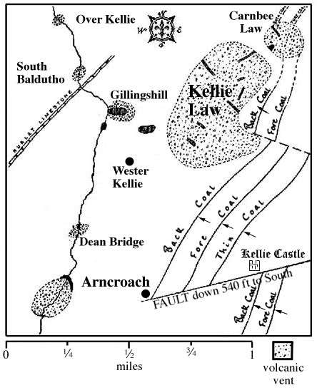
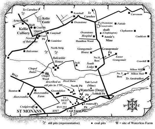
The most southerly point of the known outcrop of the Kellie Coals was about 400 yds. north of Balcaskie House, about one mile to the south-east, where a line of old pits indicated former workings up to a fault line having a southerly downthrow of 40 yds. The workings then ran northwards until, within 100 yds. of Kellie Castle, a large east and west fault, having a downthrow to the south of 180 yds., was found to shift the outcrops about 700 yds, to the west (see sketch map). It is reported that as the miners approached this fault, the Fore Coal increased in thickness to 13 ft. and the dip became more rapid. North of this fault, the coals were found to be crossed by two 'trap-dykes' which did not shift them but which converted them into a kind of anthracite or 'blind coal'.
On the south-east side of Kellie Law, the coals were thrown down to the south by a fault which displaced them about 9 ft. Beyond this, the coals proceeded a short distance under the overlying trap of Kellie and were there turned up nearly on edge. The coals here were described as 'much spoiled and nearly blind' and another portion of the coals nearby, trapped in the volcanic material of the Law, had been lifted up 70 yds. Only the Fore Coal was apparently wrought on the hill, the Back Coal being so near the trap that it was completely destroyed or 'coked and blind'.
The Kellie Coals were also interrupted and destroyed by the volcanic neck of Carnbee Law to the north-east.
In the Dreel Burn, between Balcormo Mill and Gillinshill, several seams of coal were exposed, one of which, to the west of Wester Kellie, was described as a "splint coal, three feet thick." Also, in a quarry west of Kellie Mill, a seam of coal, with black shale overlying sandstone was laid open.
