Owners: possibly Walter Herd
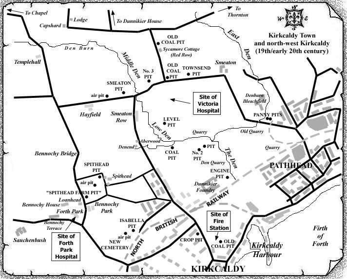
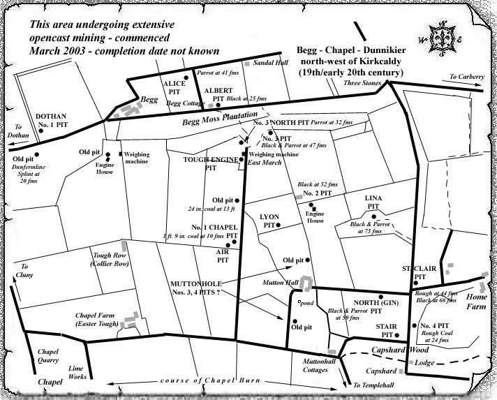
Two No. 2 Pits in different areas of the Dunnikier estate have been identified to date but they are included in this single entry since abandonment plan information does not clearly identify which of the No. 2 Pits is listed.
The Dunnikier No. 2 Pit to the north of Muttonhall would appear to pre-date the Lina Pit, which was sunk in 1874 just a few hundred yards E. S. E., by around twenty years. This pit shaft reached the Clunie Smithy Coal at 6 fathoms; the Rough Coal at 27 fathoms; and, the Black and Parrot Coals at around 57 fathoms.
Dunnikier No. 2 Pit (west of The Den and approx. 300 yards south-east of the Level Pit) probably also dates from the 1850s. This pit shaft reached the the Smithy Coal (Dunfermline Splint) at 25 fathoms; and, the Glassee (Five Feet) at 40 fathoms. An unidentified pit is located just yards to the east of this No. 2 Pit.
 |
 |
Information on coals worked in the Dunnikier No. 2 Pit (north of Muttonhall)
(based on reports from 1900-34)
In an old shaft about 375 yds. W.N.W. of the Lina Pit, the Rough Coal was recorded at 25 fathoms above the Lochgelly Splint (Black) Coal. In this same shaft, the Cardenden Smithy coal was recorded as the "Cluny Smithy" at a depth of 6 fathoms and at a level of 21 fathoms above the Rough Coal. The roof of the seam consisted of sandstone or fakes, but a bed of blaes up to 2 ft. 4 in. thick may have lain above the coal.
| Plan of Abandoned Seams for No. 2 Pit, Dunnikier | Pits or Mines designated in Plan |
|---|---|
| COAL; Black; Parrot; Five Feet; Jersey; Bright; Cairncubie (April, 1927) | Nos.
2, 3; Lina; Lyon; North; Panny Nos. 1, 2;
St. Clair No. 2; Tough |
| See also Dunnikier Colliery entry |
|---|
Can do with help on these pits.
