Owners: not known
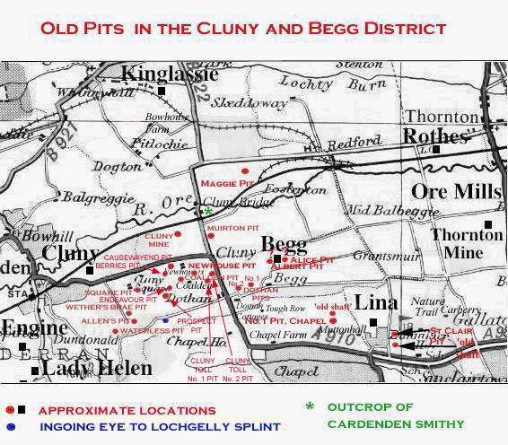
Cluny Bridge Pit (exact location not verified) worked coals in the grounds at Cluny Den, south of Cluny Bridge. The opening date for this pit is not known but it would probably have ceased coaling before 1880.
 |
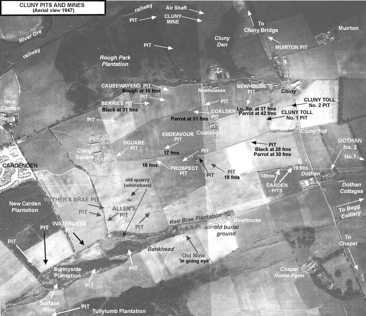 |
| See East Fife Index Entry 'Cluny Pits & Mines' for more details |
|---|
Information on coals worked at, or near, Cluny Bridge Pit
(based on a report from 1934)
The Gibbs Hall and Carden seams of the Cardenden area were
known as the Lower and Upper Smithy seams as they progressed
eastwards through the Cluny coalfield and on towards
Kirkcaldy.
The Black Coal and Parrot (or Lochgelly Splint and Parrot)
cropped out at the edge of the Sunnyside sill, which they
underlay. These seams were worked in the nineteenth century
in shallow pits sunk through the basalt, while the Carden
seam was also similarly worked to the east of Clunie Square,
at depths of not more than 16 to 19 fathoms.
The Splint and Rough Coal seams of the Dundonald and
Cardenden Collieries was known as the 'Cluny Coal'
when it came east into Cluny Colliery.
From Hyndloup, where it appeared in a ravine, its outcrop
ran eastwards by Cluny Square, Coalden and Begg, until it
began to bend with the other coals south-eastwards to the
River Forth.
The Smithy Coal of Dundonald and Cardenden, from its outcrop
at the foot of Carden Den, struck eastward into Cluny
Colliery and was exposed for 350 yards along the sides of
Cluny Den.
Throughout the Cluny coalfield, the strata dipped at low
angles towards the north, and were not seriously dislocated
by faults. So gentle was their inclination that, 800 yards
north from its outcrop, the 'Cluny Coal' was only 19
fathoms below the surface.
| Plan of Abandoned Seams for Cluny Bridge | Pits and Mines designated in Plan |
|---|---|
| COAL; Cluny Splint; Rough; Black; Parrot (1868) |
CLUNY OR CARDENDEN
Bank; Berries; Causewayend; Cluny Bridge; Cluny Toll Nos. 1, 2 ; Coalden; Cowpark; Endeavour; Newhouse; Square |
