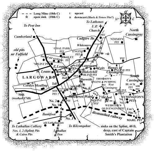
Our temporary reference for this pit is 'Cadgers Bridge' Pit, Largoward. We are hopeful that research early in 2002 will clarify the name of this 19th century coal working which was located just to the north-east of Largoward village.
|
Information on coals worked at, or near, 'Cadgers Bridge' Pit, Largoward.
(based on a report from 1900)
This pit was located on the east side of the road immediately
beyond the Cadgers Bridge, and on the north side of a large fault,
the Splint Coal was worked at a depth of 36 fathoms. The outcrops
of that coal and the other seams ran nearly due north for 500 yds.
beyond the United Presbyterian Church, when their further course
was stopped by another great fault which formed the northern
boundary of the Largoward coalfield.
The coals that were worked beyond this fracture belonged to another
and lower group, and formed a separate basin - the Lathones and
Radernie coalfield.
| See Largoward Colliery entry - East Fife Index. |
|---|
