Owners: probably Wemyss Collieries
|
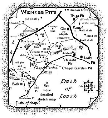
Thanks to the initial communication (see last item) from my dear late friend, William McLeod, Guardbridge, I began research into this area and uncovered locations for a few old pits. This area was very fortunately also of great interest to another friend, Peter Hall, Cupar, who has walked, and photographed, many of the old capped shafts and depressions in this and other areas of Fife, particularly to the east of Blair Den, closer to the locations of the later Lady and Victoria pits of Wemyss Colliery. |
--------------------------------------------------
Notes based on Peter Hall's explorations of the area
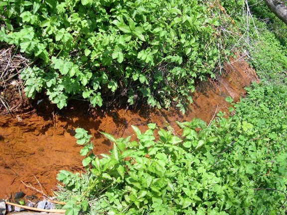
Peter Hall's first report of July, 2008, to webmaster, Chris Sparling, on his searches in this location included that he had come across a concrete-capped shaft with a stream flowing from it. He promised to take a picture, in winter, when it would show up better, as this time of year was apparently not great for exploring due to the extent of undergrowth.
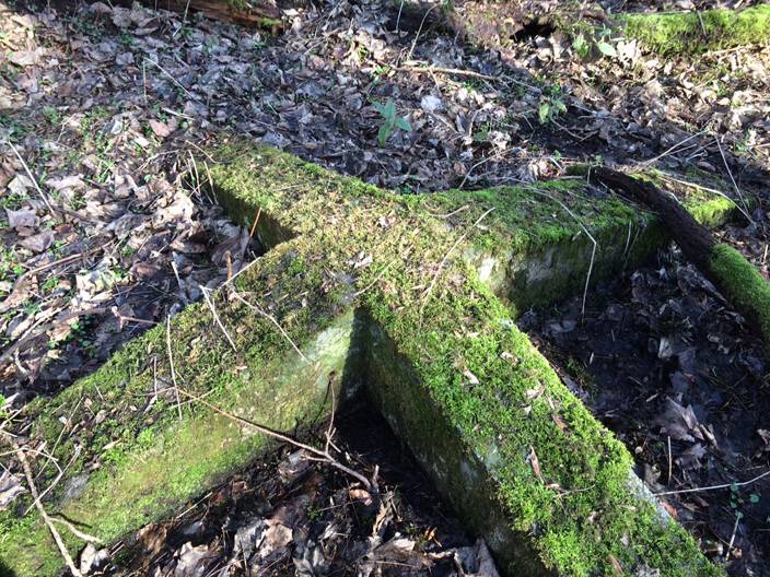
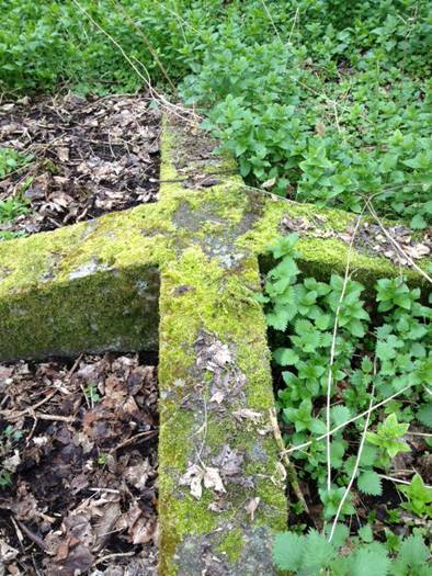
However, Peter described the top of another concrete-capped shaft as "… moss covered - has raised cross of concrete on it and remains of lifting points - no dates but looks oldish."
 |
 |
His study of early OS maps showed two shafts in this location but he had only found one so far, on several searches. There was another depression just off the path in the woods but no sign of a shaft.
Over the next few years, Peter continued to walk to most of the sites of former Fife coal mines using as a guide the website sketch maps, produced by Chris Sparling, in conjunction with his own OS maps research. Site visitors will have noted that many of Peter's fine photographs of what remains of former mine locations, buildings and features, have been added to the appropriate individual pit entries which may be accessed in the West, Central and East Fife menus.
A couple of 'meet-ups' between Peter and Chris inevitably took place and it was clear that further investigation of the former coal mine workings of the Blair Den, Chapel Wood and Chapel Garden areas was a 'must-do.' Peter's continued pursuits within old OS maps and Chris's search for old mining plans of these areas, eventually combined to strike gold, these sources revealing the existence of other pit shafts and old 'sinks' in these areas, and also in neighbouring fields to the north.
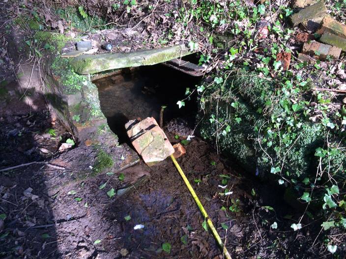
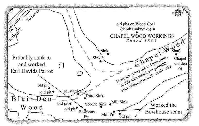
In February, 2014, Peter contacted Chris again to report on his most recent visit. A compilation of Peter's descriptions follows: " … just completed an extensive search of the Chapel Woods area, at Wemyss … has been very rewarding. Weather great and vegetation low so made search more easy. Good news - I have found the old Chapel Garden Pit shaft which is behind the allotment garden. It's of square brick construction and full of water which the house below has broken one side and inserted a hose pipe. You could see the water welling up which was very clean.
 |
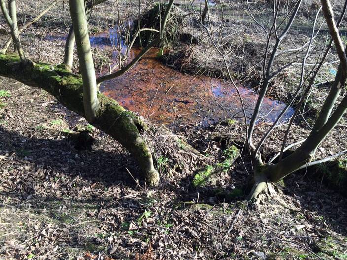
I then conducted a full search of the woods, then the row of shafts shown running NW up to Blair Den starting with the one below the Mill Pit … this has rusty mineral coloured water clearly rising up.
 |
The Mill Pit shaft is sat in a raised earth depression and is concrete-capped … well hidden.
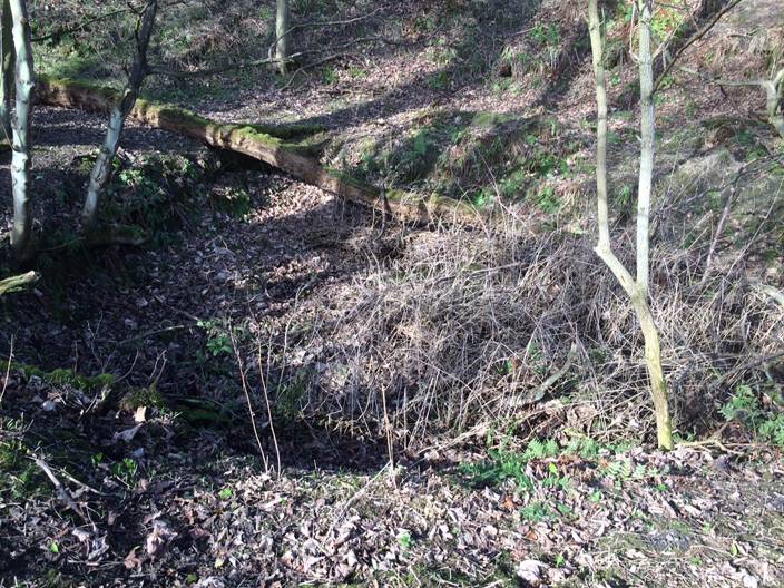 |
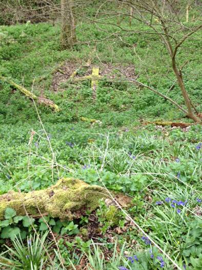
Several shafts then in a row rising following edge of the stream running down the den. Interestingly, the old fence had lots of short pieces of mine railway track in its construction. One old pit shaft has a well-defined concrete cap with a raised cross-design … it is in line with the Third Sink.
 |
 |
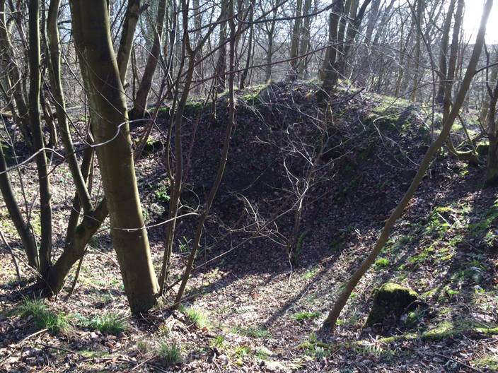 |
| Third Sink |
All the shafts and sinks that we have now identified are visible except the last two in the field above the woods. The woods running parallel to the Chapel Garden Pit location are full of raised flat platforms with steep depressions and signs of coal spoils. Lots of depressions which I think are filled shafts and pits. One depression sounded hollow when tapped with a stick so I didn't climb into it. Another had a visible hole at the bottom, so some new finds. The lower shaft from which the mineral-stained water is coming out of is shown on the OS maps as a horseshoe-shape, just below Mill Pit, which you can just make out on the map. The woods here are full of other coal workings which isn't surprising and these probably date from the early days of mining in this area … this certainly is an interesting area of mining history over the centuries."
--------------------------------------------------
 |
 |
--------------------------------------------------
| Plans of Abandoned Seams for Wemyss | Pits or Mines designated in Plans |
|---|---|
| COAL; Bowhouse; Earl's Parrot (1838) | Bowhouse; Mill |
| COAL; Bowhouse (1902) | Hugo; Lady; Mill; Victoria |
------------------------------------------------
The pit shafts of the Blair burn, near Dysart, remembered
"There were two of these in my young day beside a path that my chums and I often followed from the Dysart /Coaltown of Wemyss main road - jumping over the dyke in the process. Both were apparently water-filled and both surrounded by brick walls - from memory around four to five feet high. The lower one was much larger in cross-section and obviously contained much more water. It was close to the Blair burn and the iron oxides leaking from the old shaft stained the water a deep red (which as a small child walking with my grandfather, or father, amazed me mightily). The old track from Dysart to West Wemyss crossed this tiny burn. The track had been used by the women folk of West Wemyss going to work in Normand's mills and weaving sheds in Dysart. At an early stage the first part of this path west of the Victoria Pit shaft had been called the "Lock-out road" as it had been made manually by the Wemyss colliers during a strike that finished as a Lock-out.
The Lady Emma Pit - shortened to the Lady - had vanished by my childhood but my grandfather, prior to 1933, pointed out the manhole in the plugging which marked the shaft. I did not see confirmation or pictures of this until around 10-15 years ago!
The wooden shovel to which my grandfather would take me to see in Kirkcaldy museum had come, I suspect, from the Blair pit. Perhaps it is still there, but when I returned to Fife it seemed to have vanished - possibly it was temporarily in store. I seem to recall that old workings were also broached from the 'Dubby' - and tools found.
Sometime after the war, the NCB were apparently much concerned about air entering the Dysart seams as they were extremely prone to spontaneous combustion, and attempts were made to seal off any sporadic potential air-entry point. I have a feeling that the Blair shafts and the old Balgreggie pit were all plugged with this in mind. Stern instructions were given to the civil engineers on the Thornton bypass as it more or less passes directly over the old Ores Mill pit whose engine-house ruins I remember well.
A short distance after passing the lower Blair shaft, the path to Dysart climbed steeply up the sandstone cliff and at its side stood the "Man in the Rock" carving surrounded by a low stone plinth and an iron railing. The path wound up and passed across the original Frances Colliery bing before passing through the fringe of the Dubby pit yard. Before I returned to Fife, the whole of the path adjacent to the carving /plinth, and carving, had collapsed into the sea and vanished forever. The new path scrambles over the headland."
William H. MacLeod
February, 2005
